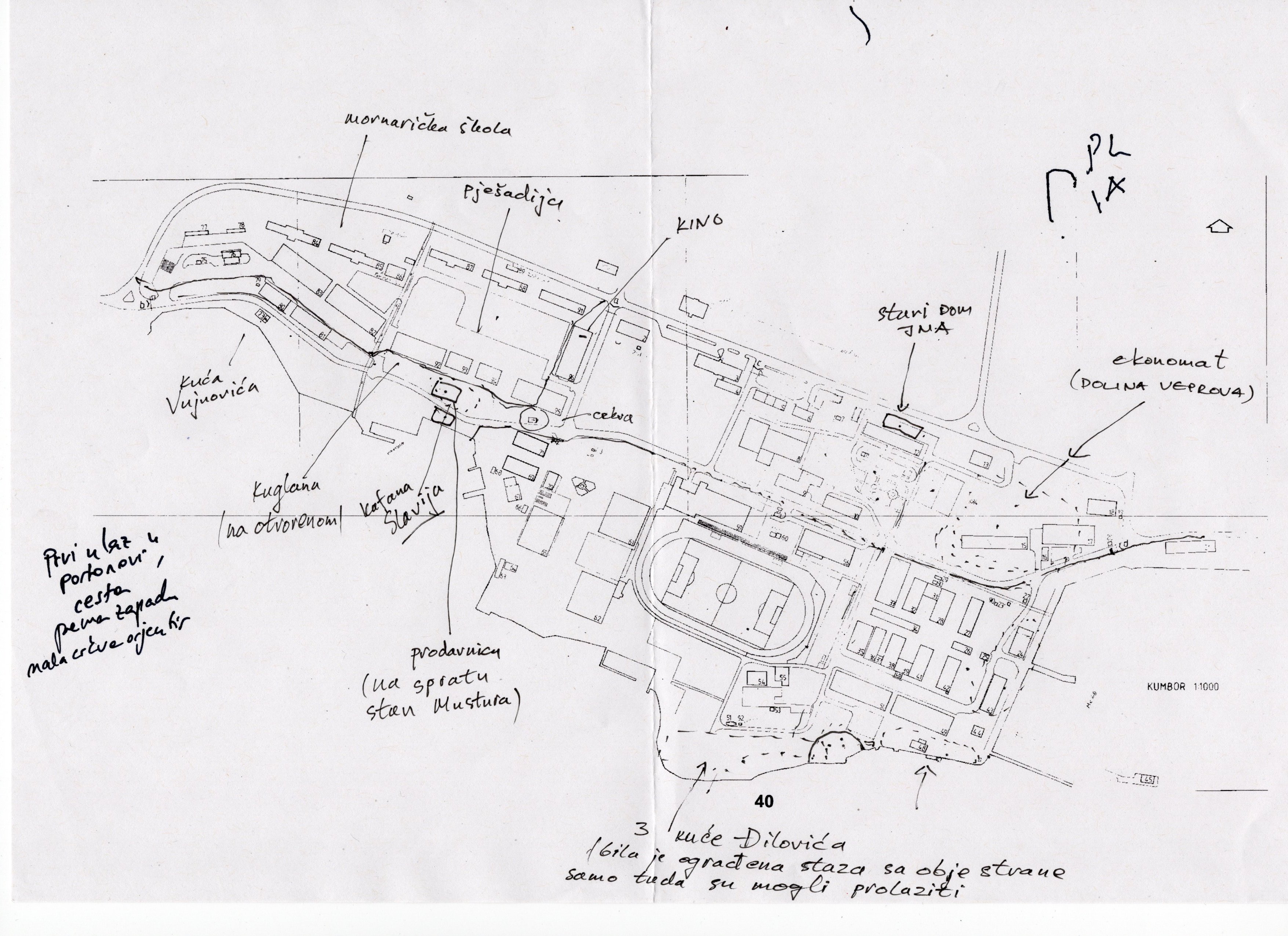
Drawing of the use of the barracks area until the end of the 1970s by Dako Mustur, 2022.
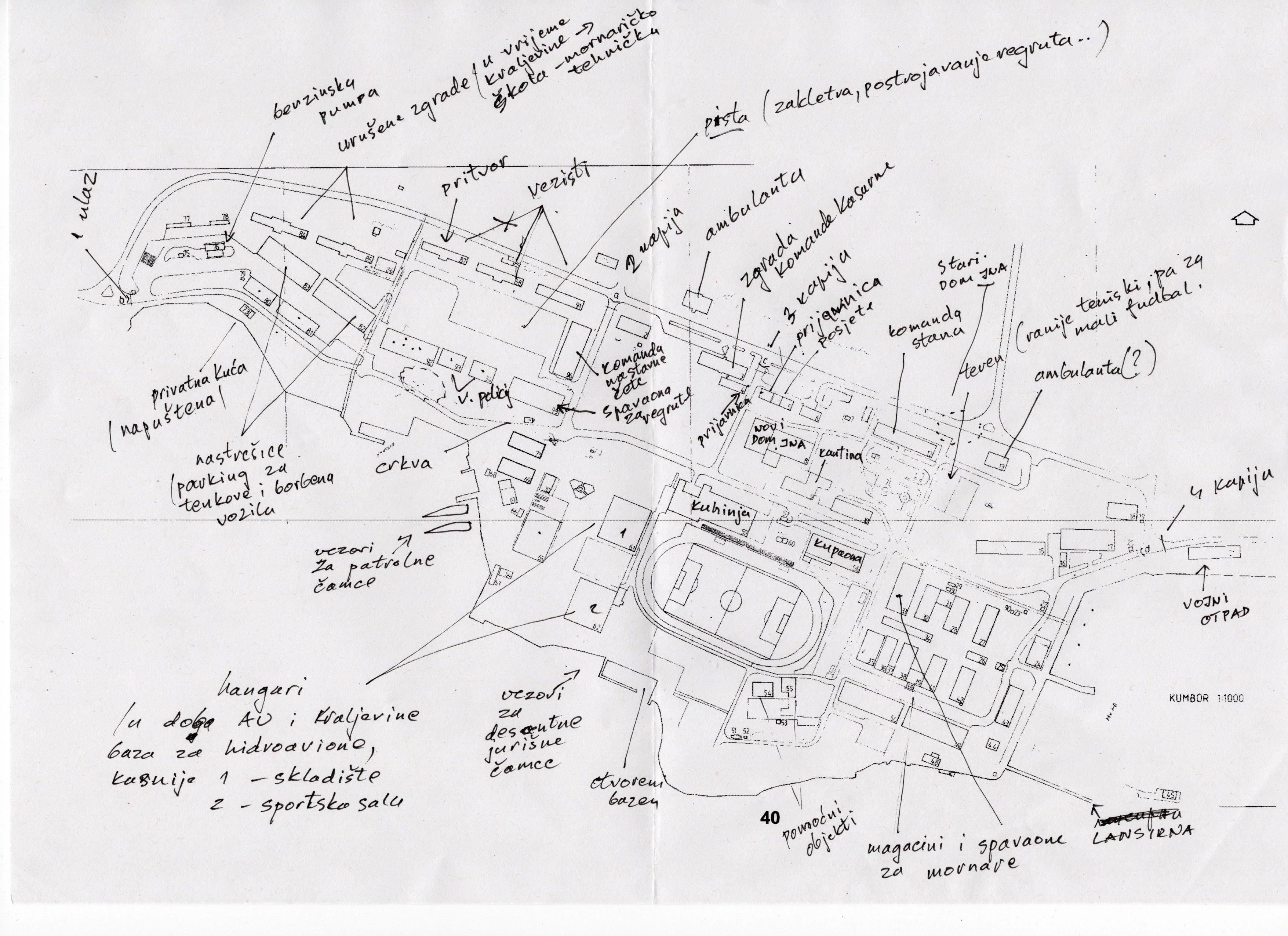
Drawing of the use of the barracks area from the 1970s to the 1990s by Petar Mustur, 2022.
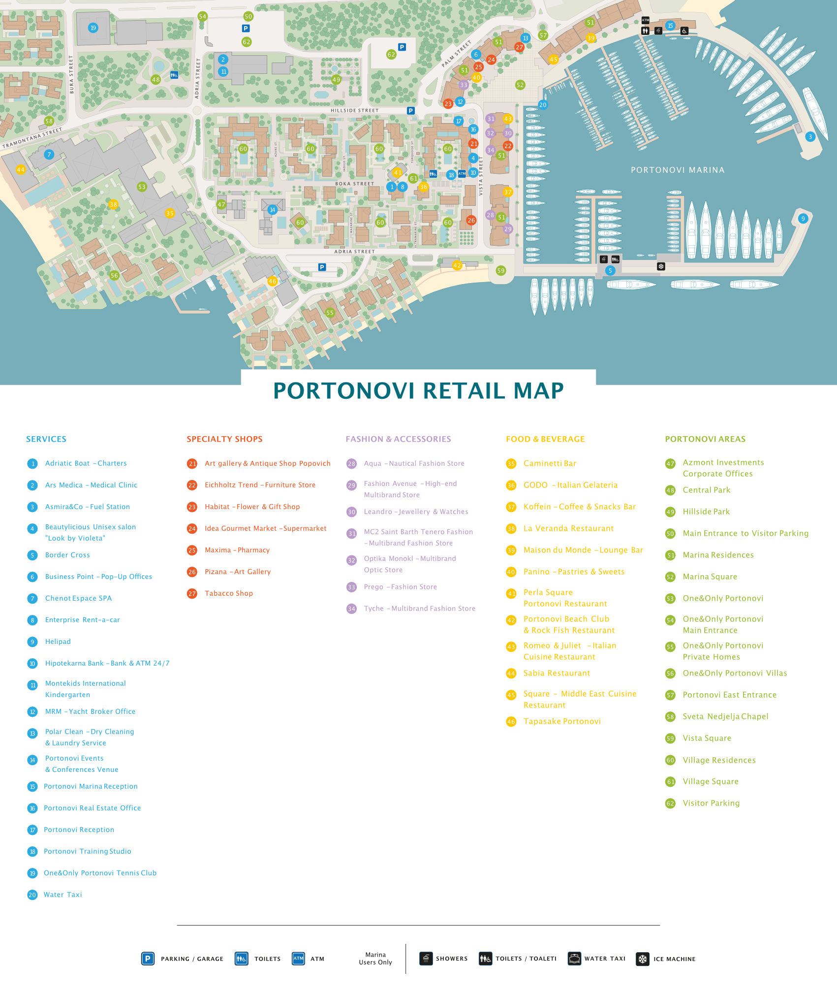
Current use of the former barracks area (Source: https://portonovi.com/storage/app/media/Portonovi%20Retail%20Map_Opt.pdf). The western part of the site (not on the map) is not yet developed and fenced off.
Until the end of the 1970s, a much smaller area of the military installation was cordoned off. The main access road led through the military area. Military use was interwoven with civilian use. Today, the pathway through the tourism complex is open to everyone. Public parks and squares have been created. However, the sea zone is mostly closed off for private and tourist use.
The pictures show drawings of memories of the military zone by Dako and Petar Mustur, father and son, whose home in Kumbor is in the immediate vicinity of the former barracks area. Petar served his military service in the Kumbor barracks. Dako, now retired, was a long-time employee of the military shipyard and overhaul institute Sava Kovačević in Tivat.